Flood Map Drawings -
Paumanok Rising Again
Hurricane Sandy brought devastating floods to my Port Washington neighborhood and inspired me to investigate local climate change issues.
I began making these artworks after studying local flood maps which depict elevations and boundaries between land and water. Layers of ink portray flood waters obliterating and altering the landscape.
Flood Map Drawings
These paintings use layered imagery to explore tensions between the human and the natural world.
My experience living through Hurricane Sandy instilled a personal awareness of interconnected natural systems and the tenuous relationships between these systems. Research into these issues heightened my awareness of the stress human activity places on Long Island’s waters and its shrinking tidal marshes.
I began making these artworks after studying local flood maps which depict elevations and boundaries between land and water. Working on translucent mylar gave me the ability to gradually build up the image in layers of graphite and ink. Layers of ink portray flood waters obliterating and altering the landscape.

Paumanok Rising Again-
Roads Become Rivers

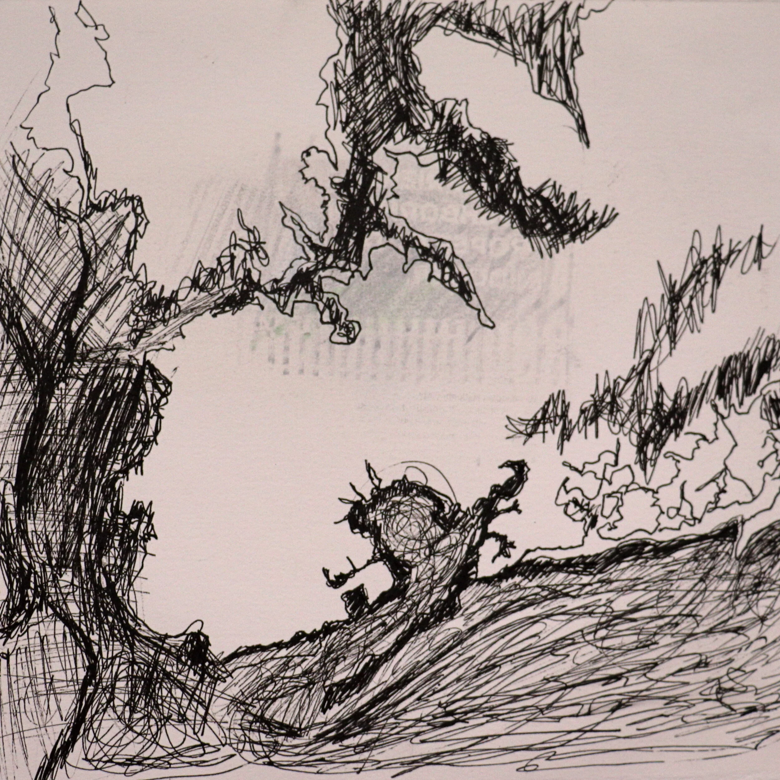
Flood Waters Surround, pen and ink on paper, (10" x 10")
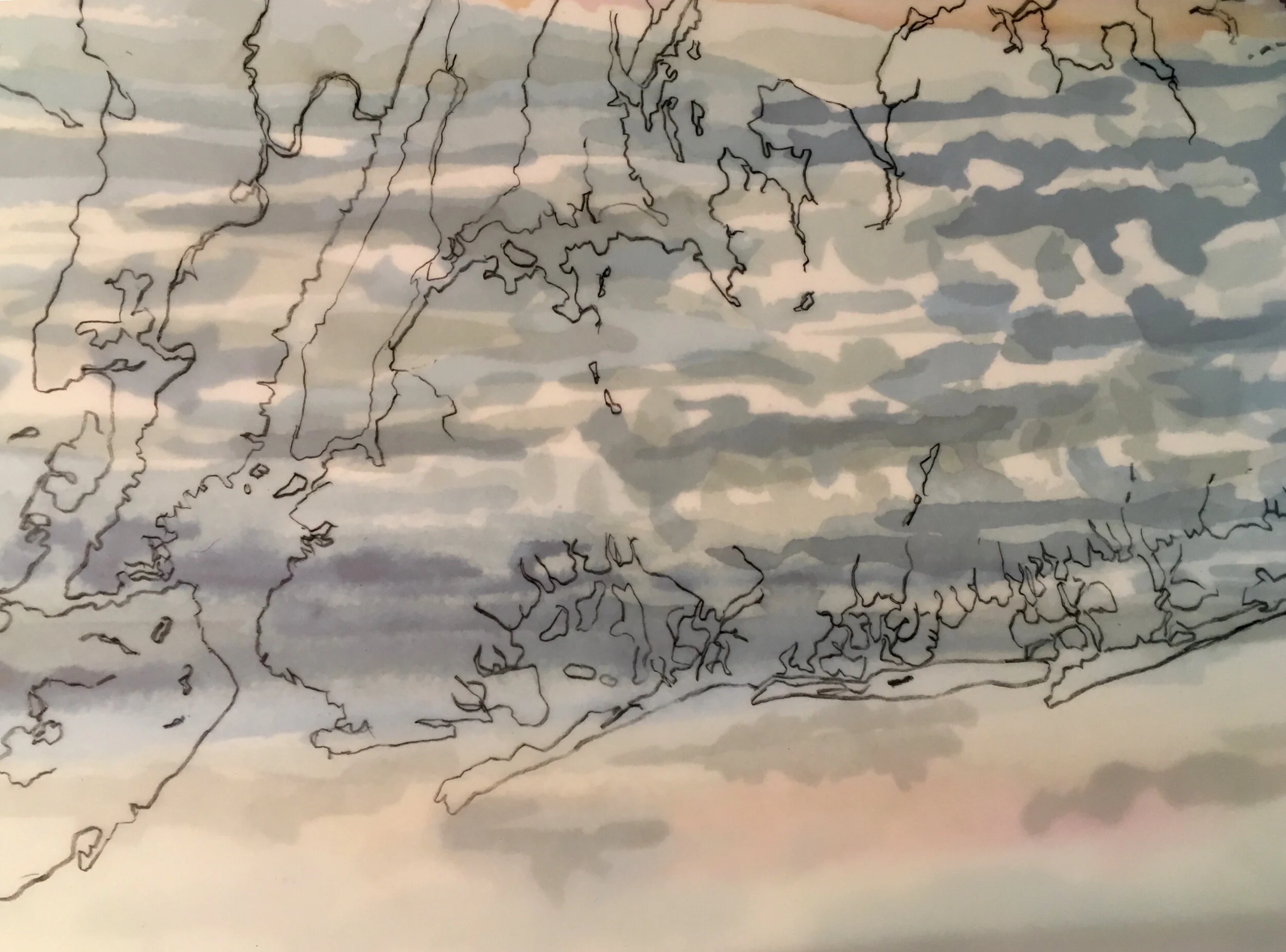
Flood Plain, graphite on translucent vellum and watercolor on paper, (9.5" x 11")

Roads Become Rivers II, graphite and ink on translucent vellum, (17" x 14")

Roads Become Rivers II, graphite and ink on translucent vellum, (17" x 14")

When Roads Become Rivers, graphite and ink on translucent vellum, (14" x 17")
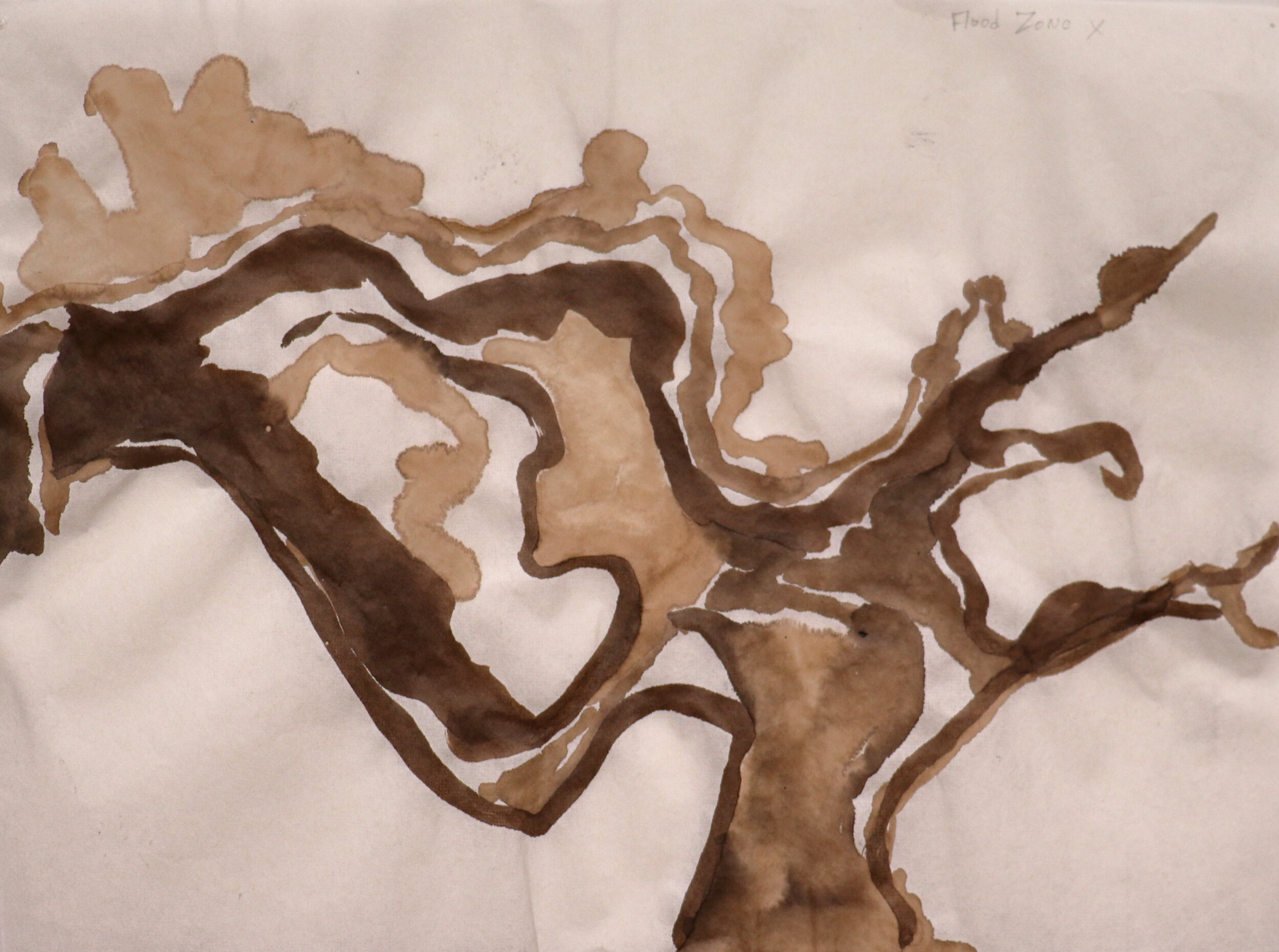
Flood Zone X, walnut ink on paper, (9.5" x 13")

Flood Zone XX, ink on rice paper, (9.5" x 13")
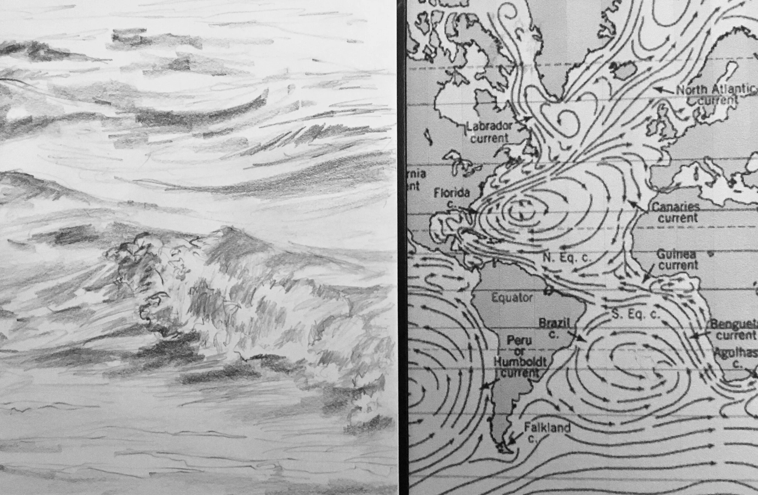
Currents From There to Here, graphite drawing and illustrated map, (9.5" x 14")

Flood Zone XXX, ink on rice paper, (9.5" x 13")
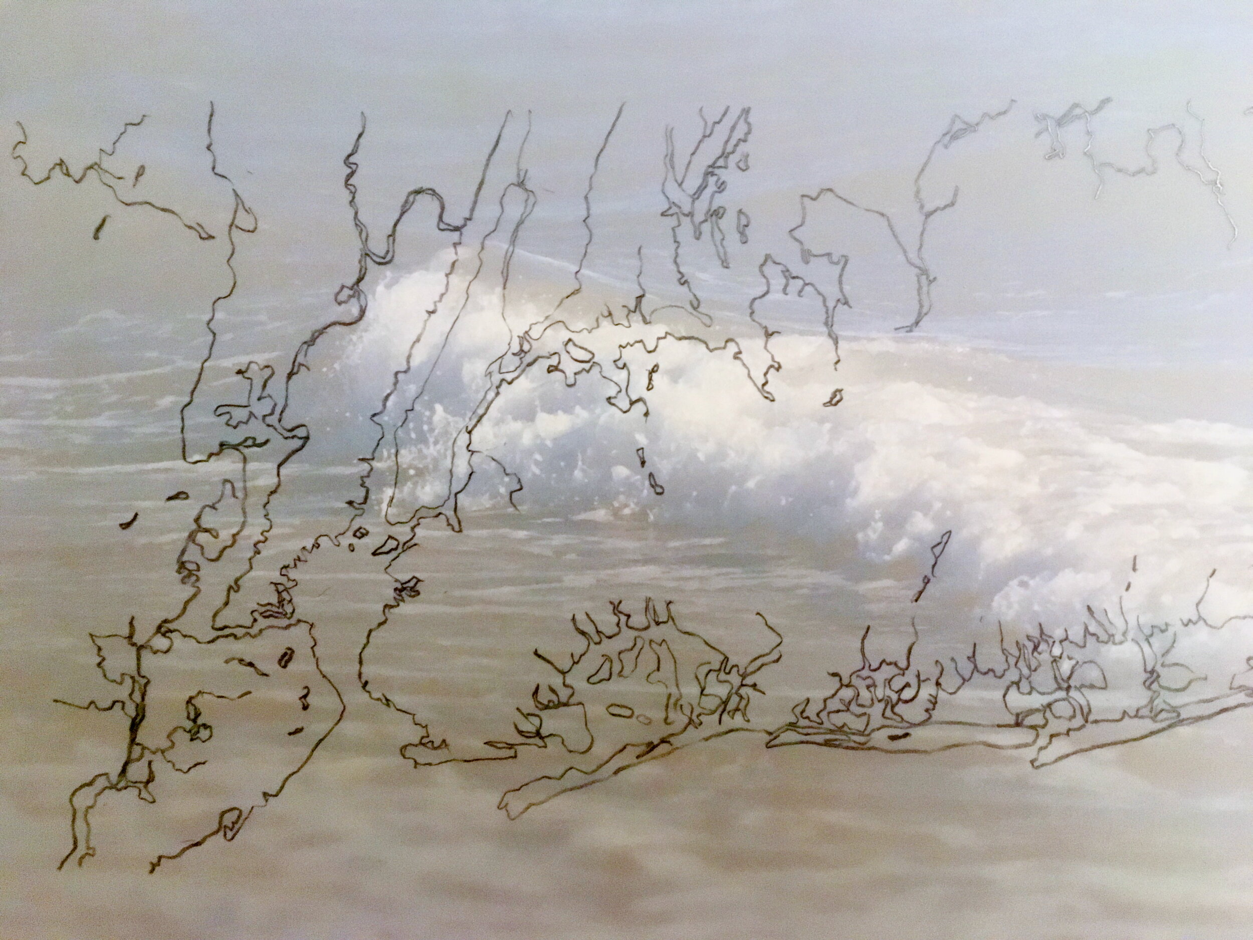
Submersion, graphite on translucent vellum on top of photograph, (9.5" x 11")
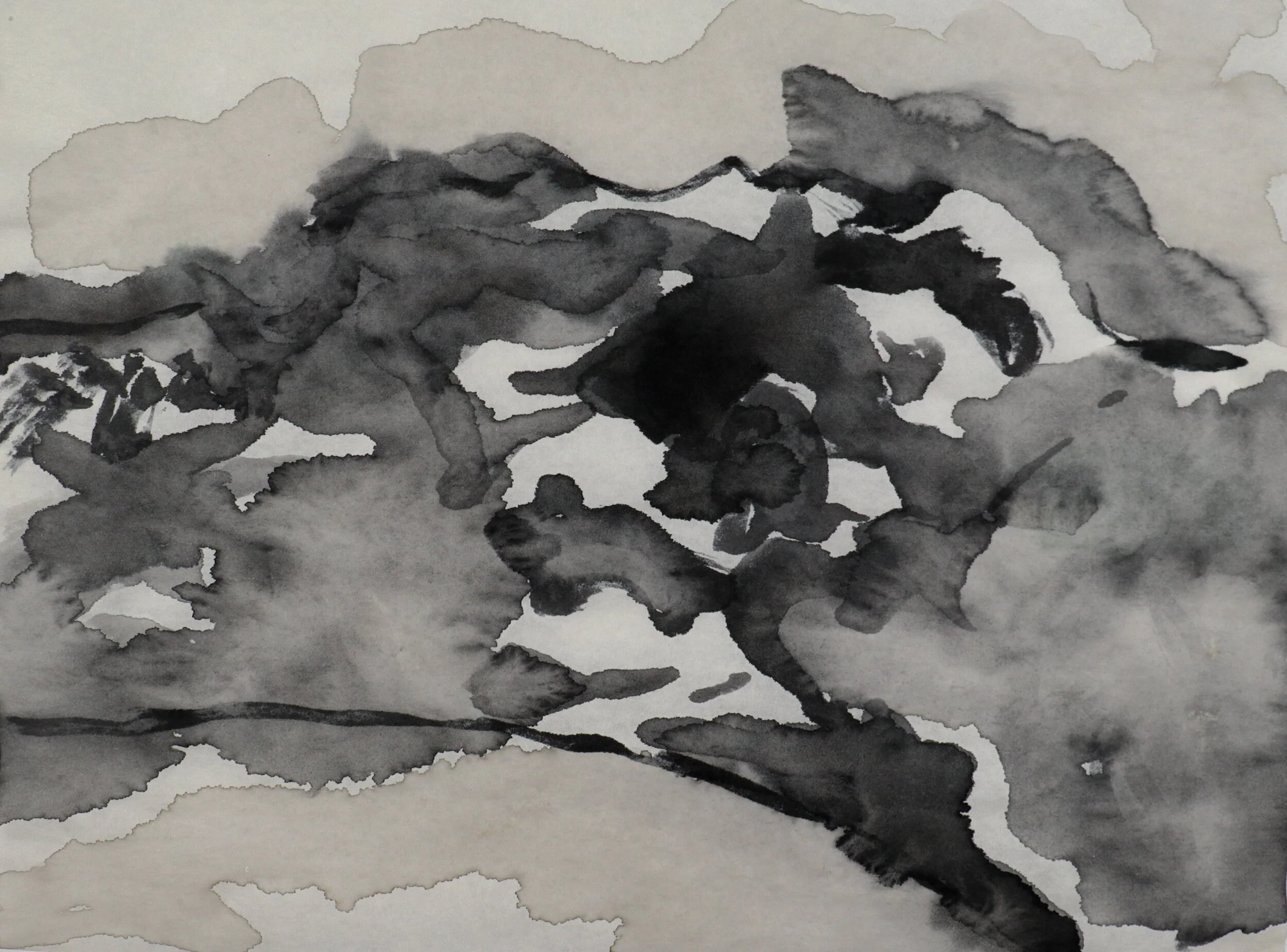
Flood Zone AE, ink on rice paper, (9.5" x 13")